UN
9 Kings Farm Lane
£ 223,000
Description
We don't have a Description for this property.
- Bedrooms
- 4
- Bathrooms
- 0
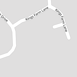

Leaflet © OpenStreetMap contributors
The heatmap indicates the level of crime in the area. The color of the heatmap indicates the crime severity and recency.
Metrics Year-on-Year
- Average area value
- 321,495.00 £Increased by 0.86 %
- Average area rental value
- 963.00 £/moIncreased by 8.20 %
- Est rental Yield
- 3.59 %Increased by 7.16 %
- Crime Rate
- 46.00 %Unchanged by 0.00 %
from 318,750.00 £
from 890.00 £/mo
from 3.35 %
from 46.00 %
Nearby Schools
| Name | Type | Ofsted | Distance |
|---|---|---|---|
| Winkleigh Primary School | Foundation School | Good | 0.50 KM |
| Acorn School | Other Independent Special School | Good | 0.96 KM |
| Exbourne Church Of England Primary School | Academy Converter | 7.72 KM | |
| North Tawton Community Primary School And Nursery | Academy Converter | 8.70 KM |
Images
Nearby Streets
| Name | Average Price | Average Sqft | Distance |
|---|---|---|---|
| Castle Street | £ 425,000 | 0 | 0.00 KM |
| Carrionpit Lane | £ 0 | 0 | 0.00 KM |
| Church Hill | £ 580,000 | 0 | 0.00 KM |
| Lower Town | £ 370,000 | 0 | 0.00 KM |
| Lendon Way | £ 0 | 0 | 0.00 KM |
Nearby Transport
| Name | NLC | TLC | Distance |
|---|---|---|---|
| Eggesford | 5822 | EGG | 8.54 KM |
| Sampford Courtenay | 8724 | SMC | 9.74 KM |
| Kings Nympton | 5823 | KGN | 9.78 KM |
Nearby Listings
| Address | Price | Type | Score | Distance |
|---|---|---|---|---|
| Kings Farm Lane, Winkleigh, Devon | £ 231,250 | BUY | 6 / 10 | 0.02 KM |
| Kings Farm Lane, Winkleigh, EX19 8HF | £ 290,000 | BUY | 7 / 10 | 0.03 KM |
| Kings Farm Lane, Winkleigh, Devon | £ 345,000 | BUY | 6 / 10 | 0.05 KM |
| Winkleigh, Devon | £ 370,000 | BUY | 5 / 10 | 0.06 KM |
| Kings Meadow Drive, Winkleigh | £ 355,000 | BUY | Unknown | 0.09 KM |
Nearby Properties
| Address | Price | Distance |
|---|---|---|
| 9 Kings Farm Lane | £ 223,000 | 0.00 KM |
| 2 Kings Farm Lane | £ 223,500 | 0.00 KM |
| 6 Kings Farm Lane | £ 230,000 | 0.00 KM |
| 8 Kings Farm Lane | £ 320,000 | 0.00 KM |
| 12 Kings Farm Lane | £ 325,000 | 0.02 KM |